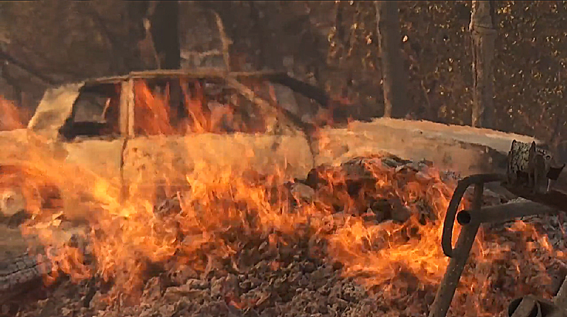
California Statewide Fire Summary for Sept. 27, 2021

CALIFORNIA (Sept. 27, 2021) — Nearly 10,400 firefighters remain on the frontlines of 11 major wildfires and one extended attack wildfire in California.
On Monday, firefighters also responded to 27 initial attack wildfires across the state. Since the beginning of the year, there have been 7,713 wildfires that have burned more than 2.4 million acres in California. In comparison, during the same time last year, there were 8,437 fires, which burned more than 3.7 million acres.
The Monument Fire is now the 14th largest fire in California history. Caldor is the 15th largest, and the River Complex is the 17th largest.
A Red Flag Warning now in effect through Tuesday morning due to strong gusty wind and low humidity for the Northern Sierra Nevada Mountains through the Lake Tahoe area down to Mono County. Wind gusts up to 50 MPH possible. Significant cooling Monday and Tuesday followed by a warming and drying trend from midweek onward. Southwest winds from the Cascade/Sierra crest eastward will continue to increase with gusts 30-40 mph over broad areas this afternoon and evening and stronger gusts of 50 mph or more possible along high Sierra ridges.
Rain along the North Coast will spread inland over the northwest mountains Monday. In Southern California a pacific trough will move over the West Coast through Tuesday. Westerly winds of 20 to 40 mph with gusts to 60 mph will surface across the wind prone mountain and desert areas this afternoon through Tuesday evening. Temperatures will fall well below normal through Tuesday.
Prepared for a wildfire should one strike nearby? With Red Flag conditions in place, fires in these areas can spread rapidly. Making a quick and safe evacuation is critical to protecting your life and your family. To learn ways to prepare, visit www.ReadyForWildfire.org.
State Incidents
Fawn Fire, Shasta County (more info…) Northeast of Shasta Lake
- 8,577 acres, 65% contained
- Evacuation orders and warnings remain in place
- CAL FIRE IMT Team 4 (Pemberton) in command
Unified Command Fires
Dixie Fire, Butte, Plumas, Lassen, Tehama & Shasta Counties (more info…) Feather River Canyon
- 963,276 acres, 94% contained
- 2nd Largest and 14th Most Destructive Wildfire in California history
- Damage assessment is ongoing
- Repopulation plan implemented and ongoing
- Unified Command CAL FIRE, USFS
- Rocky Mountain Team Black (Hagan) – West Zone
- Southern Area Gold Team (Beard) – East Zone
French Fire, Kern County (more info…)
West of Lake Isabella – Sequoia National Forest
- 26,535 acres, 98% contained
- Unified Command USFS and BLM
Windy Fire, Tulare County (more info…)
Tule River Indian Reservation – Sequoia National Forest
- 85,383 acres, 2% contained
- Unified Command USFS, TIA and TCFD
- CA IMT team 5 (Young) in command
Federal Incidents
Antelope Fire, Siskiyou County (more info…) South of Tennant – Klamath National Forest
• 145,632 acres, 95% contained
Caldor Fire, El Dorado, Amador & Alpine Counties (more info…) South of Grizzly Flats – El Dorado National Forest
- 221,774 acres, 76% contained
- 15th Largest and 16th Most Destructive Wildfire in California history
- CA IMT Team 12 (Nobles) in command
KNP Complex, Tulare County (more info…) Milk Ranch Peak – Sequoia National Park
- 46,976 acres, 8% contained
- Southern Area Blue Team (Morales) in command
- Includes the Paradise Fire and Colony Fire
McCash Fire, Siskiyou County (more info…)
Ten Bear Mtn McCash Creek – Six Rivers National Forest
- 93,176 acres, 41% contained
- Alaska IMT Team 1 (McDonald) in command
Monument Fire, Trinity County (more info…) West of Big Bar – Shasta-Trinity National Forest
- 222,323 acres, 69% contained
- 15th largest wildfire in California history
- Southern Area Red Team (Parrish) in command
River Complex, Siskiyou & Trinity Counties (more info…) West of Callahan – Klamath National Forest
- 198,248 acres, 67% contained
- 17th largest wildfire in California history
- CA IMT Team 15 (James) in command
Tamarack Fire, Alpine County (more info…)
South of Gardnerville – Humboldt-Toiyabe National Forest
• 68,637 acres, 84% contained
Extended Attack Incidents
Emigrant Fire, Los Angeles County (more info…) Near Pyramid Lake
• 255 acres, 98% contained
Large Wildfire Breakdown
Note: Information data gathered from ICS-209s available as of 0700
| Incident Name (County) | Acres | % Contained | Total Structures | ||
| Threatened | Damaged | Destroyed | |||
| Antelope Fire (Siskiyou) | 145,632 | 95% | 5 | 4 | 18 |
| Caldor Fire
(El Dorado/Amador/Alpine) CA IMT Team 12 (Nobles) |
221,774 |
76% |
1,353 |
81 |
1,003 |
| Dixie Fire (Butte/Plumas/Lassen/Tehama/Shasta)
Rocky Mountain Team Black (Hagan) – West Zone Southern Area Gold Team (Beard) – East Zone |
963,276 |
94% |
0 |
95 |
1,329 |
| Fawn Fire (Shasta)
CAL FIRE IMT Team 4 (Pemberton) |
8,559
(+22) |
50%
(+15) |
2,340 | 22
(+6) |
155
(+21) |
| French Fire (Kern) | 26,535 | 98% | 0 | 6 | 49 |
| McCash (Siskiyou)
Alaska IMT Team 1 (McDonald) |
93,176
(+293) |
41% | 115 | 0 | 0 |
| Monument Fire (Trinity)
Southern Area Red Team (Parrish) |
222,323
(+2,900) |
69% | 118 | 3 | 50 |
| KNP Complex (Tulare)
Southern Area IMT Blue Team (Morales) |
46,976*
(+2,148) |
8% | 158
(+7) |
0 |
0 |
| River Complex (Siskiyou/Trinity)
CA IMT Team 15 (James) |
198,248
(+259) |
67%
(+2) |
620 |
2 |
122 |
| Tamarack Fire (Alpine) | 68,637 | 84% | 0 | 7 | 25 |
| Windy Fire (Tulare)
CA IMT Team 5 (Young) |
85,383*
(+10.852) |
2% | 2,975 | 0 | 3 |
*Updated acreage based on incident information released after ICS-209 0700 taken from Inciweb.
