Cry me a river — an atmospheric river
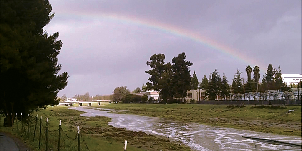
 SAN FRANCISCO BAY AREA (Nov. 9, 2021) — Many one-day rainfall records were shattered when the first significant storm of the season soaked the Bay Area last month.
Our drenching downpours resulted when the jet stream guided a large plume of moisture toward a strong storm system that developed off the Pacific Northwest coast.
For the last several decades, meteorologists have identified large, organized streams of moisture that move eastward across the Pacific Ocean as atmospheric rivers (AR). The October AR turned out to be one of the strongest on record.
ARs are long and relatively narrow bands of water vapor, typically several hundred miles wide and often more than 1,000 miles long. There are varying amounts of water vapor in each river, dependent mainly on the moisture available in the source region of the flow.
When an AR moves across the Pacific toward the Bay Area, forecasters expect rain. Rainfall amounts are a function of how much atmospheric water is contained in the AR and how long the moisture plume affects a location.
AR categories
A few years ago, research meteorologists developed a methodology to categorize an impending AR’s potential effects. These forecasts are designed to assist water managers and emergency response organizations with short-term planning strategies.
Similar to hurricane strength classifications, there are five AR categories. CAT-5 is the strongest. However, there is an important distinction in what the weak and strong categories represent.
All hurricanes, weak or strong, result in property damage and possible loss of life. Weak ARs, however, are considered beneficial in that they provide needed rainfall over a short period of time. For example, scientists estimate that atmospheric rivers are responsible for 30% to 50% of California’s annual rainfall.
CAT-5 AR storms are slow-moving, moisture-laden events. They produce prodigious rainfall activity that can last for several days. CAT-5 AR storms often trigger flash floods and landslides.
The key variable used to classify an AR at a specific location is the integrated vapor transport (IVT). Satellite water vapor measurements quantify the amount of available moisture in a column of air.
These moisture measurements, combined with modeled wind flow data, allow forecasters to calculate IVT values. The goal is to determine the number of hours that predefined threshold IVT conditions will persist at a given location.
The Oct. 24-25 AR was a CAT-5 storm for most of Central California, including the Bay Area. Local rainfall totals ranged from 5 to 15+ inches during this event. Downed trees, flooding and several landslides occurred throughout the Bay Area.
Fire hose
Before the rains began, several meteorologists described satellite photos of the impending AR as resembling a fire hose aimed at Northern California. That turned out to be an accurate assessment. Rainfall that doused our state also ended the horrible wildfire fire season that began in August.
In an average year, three to four weak to moderate strength AR events strike the Bay Area. Strong CAT-5 AR storms, however, are relatively rare. After two dry rainy seasons, the recent AR seemed to provide more benefits than harm as reservoir and lake levels increased substantially.
Meteorologists agree, however, that the October AR didn’t end the drought. But I hope it is the starting point for a wetter than normal winter season. If we’re lucky, California will experience a few more AR events in the coming months.
Read more weather articles on the Pioneer.

Woody Whitlatch
Woody Whitlatch is a meteorologist retired from PG&E. Email your questions or comments to
clayton_909@yahoo.com