California Statewide Fire Summary, September 16, 2021
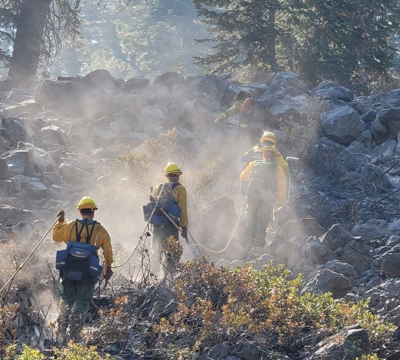
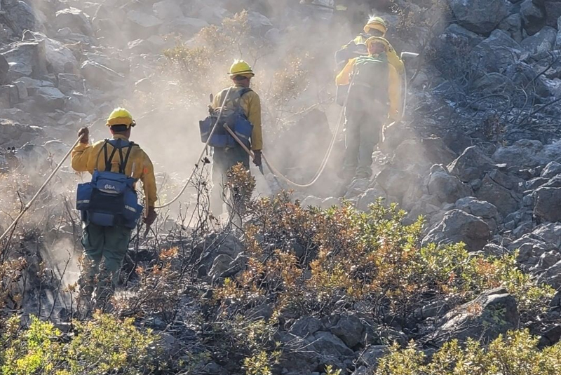
CALIFORNIA (Sept. 16, 2021) — More than 10,300 firefighters continue to work towards containment on 14 major wildfires and one extended attack wildfire burning in California.
On Thursday, firefighters also responded to 15 new wildfires, all of which were quickly contained. Since the beginning of the year, there have been 7,465 wildfires, which have burned more than 2.27 million acres. The U.S. Forest Service ended the reginal closure order affecting national forests in California yesterday, but closures remain in place for the El Dorado, Los Padres, Angeles, San Bernardino, and Cleveland National Forests due to local weather and fire factors.
A Fire Weather Watch has been issued for this weekend due to gusty winds and low humidity in Lassen and Modoc counties, as well as parts of Madera, Mono and Alpine.
In Northern California, there is a high risk for strong winds and low relative humidity for the crest eastward Friday. There is a chance of precipitation throughout the weekend in the northwest part of the state. Temperatures will be cooler beginning tomorrow and will warm early next week. In Southern California, high pressure is expected over the desert that will gradually weaken as a low pressure system approaches the region and begins to merge with a trough over the west coast. Temperatures will remain above average through today.
Southwest afternoon and evening winds of 15 – 25 mph with gusts to 40 will periodically surface over the wind prone mountain and desert areas through Friday, with stronger west northwest winds with gusts to 50 mph expected across the mountains and deserts Saturday through Monday.
Are you and your family prepared for an emergency? You can prepare not only for a wildfire, but any disaster that may strike. Make sure you and your family are ready for anything! To learn more, visit www.ReadyForWildfire.org.
Fires of Interest
Unified Command Fires
Caldor Fire, El Dorado, Amador & Alpine Counties (more info…) South of Grizzly Flats – El Dorado National Forest
- 219,267 acres, 71% contained
- 15th Largest and 16th Most Destructive Wildfire in California history
- More than 13,600 structures remain threatened; 1,003 structures destroyed
- Damage inspection is ongoing
- Evacuation orders and warnings remain in place
- Repopulation ongoing where safe to do so
- Unified Command CAL FIRE and USFS
- CAL FIRE IMT Team 2, NIMO Team 2, and CA IMT Team 4 in command
Dixie Fire, Butte, Plumas, Lassen, Tehama & Shasta Counties (more info…) Feather River Canyon
- 960,583 acres, 86% contained
- 2nd Largest and 14th Most Destructive Wildfire in California history
- More than 1,600 structures threatened, 1,329 destroyed
- Damage assessment is ongoing
- Evacuation orders and warnings in place for multiple communities
- Repopulation ongoing where safe to do so
- Unified Command CAL FIRE, USFS, BLM, and National Park Service
- CA IMT Team 14, CA IMT Team 1, and NIMO Team 1 in command
French Fire, Kern County (more info…)
West of Lake Isabella – Sequoia National Forest
- 26,535 acres, 98% contained
- Unified Command USFS and BLM
Federal Incidents
Antelope Fire, Siskiyou County (more info…) South of Tennant – Klamath National Forest
- 145,204 acres, 73% contained
- CA IMT Team 10 (Petterson)
Beckwourth Complex, Lassen/Plumas Counties (more info…) Northeast of Beckwourth – Plumas National Forest
• 105,670 acres, 98% contained
KNP Complex, Tulare County (more info…) Milk Ranch Peak – Sequoia National Park
- 8,940 acres, 0% contained
- Southern Area IMT Blue Team in command
- Includes the Paradise Fire and Colony Fire
McCash Fire, Siskiyou County (more info…)
Ten Bear Mtn McCash Creek – Six Rivers National Forest
- 80,611 acres, 10% contained
- Great Basin IMT Team 7 in command
McFarland Fire, Shasta, Trinity & Tehama Counties (more info…) West of Platina – Shasta-Trinity National Forest
• 122,653 acres, 98% contained
Monument Fire, Trinity County (more info…) West of Big Bar – Shasta-Trinity National Forest
- 215,944 acres, 50% contained
- 16th largest wildfire in California history
- Northern Rockies IMT Team 2 in command
River Complex, Siskiyou & Trinity Counties (more info…) West of Callahan – Klamath National Forest
- 189,085 acres, 40% contained
- 19th largest wildfire in California history
- Complex is comprised of 23 fires; 16 fires contained
- CA IMT Team 2 in command
Route Fire, Los Angeles County (more info…) North of Santa Clarita – Angeles National Forest
• 464 acres, 95% contained
Tamarack Fire, Alpine County (more info…)
South of Gardnerville – Humboldt-Toiyabe National Forest
• 68,637 acres, 84% contained
Walkers Fire, Tulare County (more info…) Northeast of Springville – Sequoia National Forest
• 8,777 acres, 98% contained
Windy Fire, Tulare County (more info…)
Tule River Indian Reservation – Sequoia National Forest
- 2,520 acres, 0% contained
- CA IMT Team 11 in command
Extended Attack Incidents
Hopkins Fire, Mendocino County (more info…) Near Capella
• 257 acres, 95% contained
Large Wildfire Breakdown
Note: Information data gathered from ICS-209s available as of 0700.
| Incident Name (County) | Acres | % Contained | Total Structures | ||
| Threatened | Damaged | Destroyed | |||
| Antelope Fire (Siskiyou)
CA IMT Team 10, (Petterson) |
145,204*
(+94) |
73%
(+3) |
75 |
4 |
18 |
| Beckwourth Complex (Lassen/Plumas) | 105,670 | 98% | 0 | 23 | 148 |
| Caldor Fire
(El Dorado/Amador/Alpine) CAL FIRE IMT Team 2 (Blankenheim) – West Zone NIMO Team 2 (Reinarz) – West Zone CA IMT Team 4 (Opliger) – East Zone |
219,267 |
71% (+1) |
13,682 (-2,928) |
81 |
1,003 |
| Dixie Fire (Butte/Plumas/Lassen/Tehama/Shasta) NIMO Team 1 (Kurth) and
CA IMT Team14 (Watkins) – West Zone CA IMT Team 1 (McGowan) – East Zone |
960,583* (+113) |
86% (+11) |
1,616 |
95 |
1,329 |
| French Fire (Kern) | 26,535 | 98% | 0 | 6 | 49 |
| McCash (Siskiyou)
Great Basin IMT Team 7 (Knudson) |
80,611*
(+3,383) |
10% | 57 | 0 | 0 |
| McFarland Fire (Shasta/Trinity/Tehama) | 122,653 | 98% | 0 | 1 | 46 |
| Monument Fire (Trinity)
Northern Rockies IMT Team 2 (Turman) |
215,944*
(+1,368) |
50%
(+4) |
10,580 | 3 | 50 |
| KNP Complex (Tulare)
Southern Area IMT Blue Team (Morales) |
8,940*
(+3,079) |
0% | 0 | 0 | 0 |
| River Complex (Siskiyou/Trinity)
CA IMT Team 2 (Johnny) |
189,085*
(+1,825) |
40% | 620
(-25) |
0 | 80 |
| Route Fire (Los Angeles) | 464 | 95%
(+5) |
0 | 0 | 0 |
| Tamarack Fire (Alpine) | 68,637 | 84% | 0 | 7 | 25 |
| Walkers Fire (Tulare) | 8,777 | 98% | 10 | 0 | 0 |
| Windy Fire (Tulare)
CA IMT Team 11 (Fogle) |
2,520*
(+909) |
0% | 1,975 | 0 | 0 |