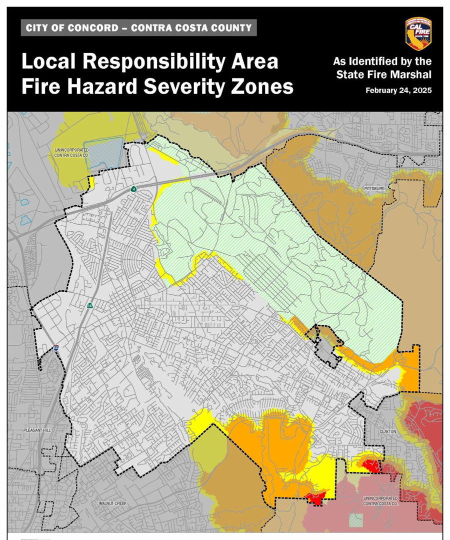
Fire Hazard Severity Zone updates for Concord: What you need to know
CONCORD, CA (Mar. 12, 2025) — As required by state law, the California Department of Forestry and Fire Prevention (CAL FIRE) recently released new Fire Hazard Severity Zone (FHSZ) maps for Contra Costa County including the City of Concord.
These maps help minimize the loss of life, resources, and property during wildfires by guiding defensible space programs and building code standards within FHSZs. Contra Costa Fire Protection District (Con Fire) has until June 24, 2025, to adopt the new map that includes Concord.
The updated maps classify areas in Concord into Moderate, High, and Very High FHSZs. New construction in High and Very High zones must adhere to Wildland-Urban Interface (WUI) building codes. This will require features like ignition-resistant materials, fire sprinklers, and enhanced standards for roofing, siding, decking, windows, and vents. These measures are designed to reduce the risk of wind-blown embers igniting structures.
To check if your property is affected or to learn more, visit www.cityofconcord.org/FHSZ.
Please note that under state law, the City of Concord cannot alter the fire hazard severity zone designations or remove areas identified by the State Fire Marshal from the map.
Staying informed and prepared is key to protecting our community. Be sure to review the updated maps and understand the requirements for your area.